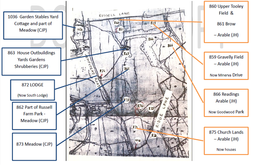
In the mid 1840s for the first time we have a detailed picture of the Estate from the tithe map and tithe apportionment for the parish of Watford. Tithes were originally a tax which required one tenth of all agricultural produce to be given annually to the church. By the early nineteenth century the system had become very inconvenient and increasingly unpopular so in 1836 the Tithe Commutation Act abolished payments in kind, replacing them with a monetary payment called a tithe rentcharge. To achieve this, the land in most parishes was surveyed to produce detailed tithe maps on which each plot of land was numbered. Accompanying these were tithe apportionments listing each plot by number and giving its owner, occupier, description, state of cultivation, area and tithe rentcharge payable, if any.
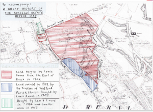
At Russells the map and apportionment shows that most of the present Estate was owned by the Earl of Essex, though a smaller part of it was owned by the parish of Watford. That area of land (shaded blue on the plan in the Lewis Evans section) was roughly rectangular in shape, its boundaries being approximately the present Ridgeway, The Drive, Hempstead Road (A411) and part of Ridge Lane.
 Key: JH = John Horncastle (tenant farmer) CJP = Charles John Pearce/Pearse (Russell House Occupant)
This map is dated 1842, and the apportionment (a list of land and buildings that are liable to tithes, along with the owners and occupiers) dated 1844.