Housing and Development of the Russell Farm Estate before 1934
It is likely that some of the houses on Ridge Lane were built before 1934. According to one report Page 113 “Until the 1920s, this area was largely occupied by farmland and woodland, while the area to the west of Ridge Lane was occupied by parkland relating to the Russells Estate” and Page 150 “During […]
Development of the Estate in the 1930’s
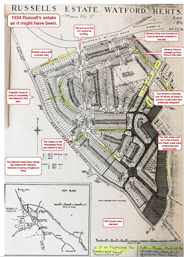
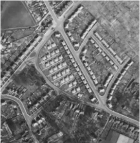
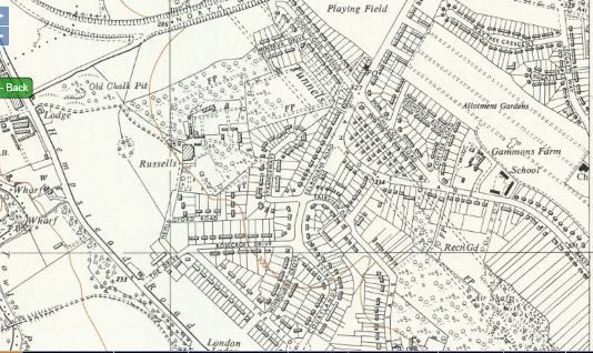
After 1934 the former country estate was being sold off for development and the area changed to a residential estate, with the original house converted into flats. This map, published in 1960, shows the new roads and houses being added – whilst some of the original estate fields and features still exist. After WWI there […]
Development in the 1940’s
1939-1945 – Second World War – Housebuilding The Second World War here, as elsewhere, soon halted the sale of plots of land and residential building – as all available labour and materials were needed for the war effort. Both only resumed when the war ended. “During the Second World War many of the country’s stately […]
Development in the 1950’s
In the 1950’s houses were still being developed in the area – for example a house was built on The Drive in 1952. The land having been sold to Francis William King in 1946 Note: A few years earlier the old drive to Russell House ran from South Lodge – behind the […]
Development in the 1960’s
By the end of the 60’s most of the current roads had been built, with the exception of the area to the North/West of Russells. Housing is steadily encroaching on the countryside, but Russell House still sits in a substantial estate. Note – The prefabs that will make way for the Hollytree House development are […]
Development in the 1970’s
1970’s “Houses on Hemingford Way and Hampden Way were built in two phases during the 1950s-1960s as residential accommodation for police officers, while Lebanon Close and the southern end of Greenbank Road were developed for the same reason in 1975. …Public housing was built in the northern part of Greenbank Road in the early 1970s.” […]
Development in the 1980’s
Russell House The 1988 fire at Russell House was a sad end to the old house and the start of its new life as apartments. See here for more information Church of Jesus Christ of Latter-day Saints In 1986 planning permission was given to build “church and associated accommodation and car park on the former […]
Development in the 1990’s
A map dated 1991 shows changes over the last few decades including: Greenbanks, which was constructed some time before 1974. Ashfields bridge prevents traffic from intersecting with the A41. Russell Lane no longer links with the A41 but still seems to be accessible from the Hempstead Road. The roundabout with the A405 has been […]
1939 Register/Census
The 1939 ‘census’ gives a useful insight into the people moving into the estate. The initial National Registration Bill was introduced to Parliament as an emergency measure at the start of the Second World War. It provided for the establishment of a constantly-maintained national register of the civilian population of the United Kingdom and the […]
World War II
Russells Estate in the Second World War According to available information, during the war Russells played a crucial role in Britain’s air defence – serving as the base for a Home Guard searchlight unit that helped anti-aircraft batteries and fighter squadrons repel night time bombing raids by the Luftwaffe. The estate was regularly used for […]
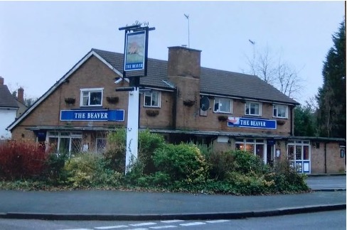
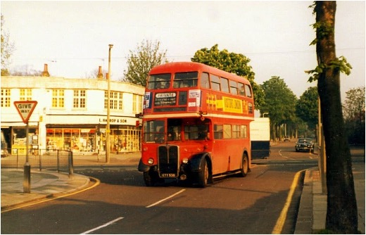
Goodwood Parade
Picture of the shops taken in 2013 Extracts from Facebook Group “We Grew Up in Watford” From the number of comments it is clear local people had many memories of the shops; “We were lucky to have such a good selection of shops just round the corner. No matter […]
Goodwood Recreation Ground
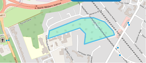
It is possible that the Goodwood Recreation Grounds were originally fields used by William Copeland to stable his racehorses and let them run. It is also possible that the land was used to ‘dump’ the waste from the tunnel and shaft excavations in the early 1800’s railway works – giving the park it’s profile. Most […]
Maps
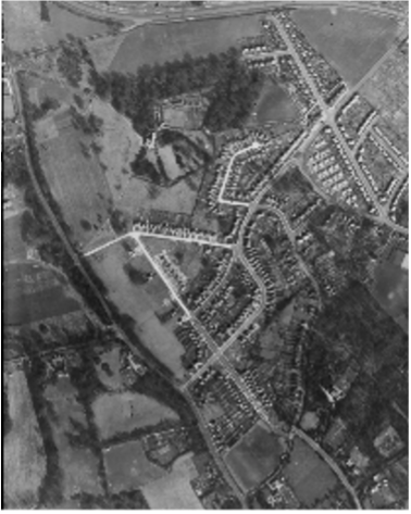
The Historic England site has over 400,000 digitised photos from their aerial photo collections of over 6 million photographs preserved in the Historic England Archive. Some of them include part of the Russell Farm Estate area. 1947 An aerial photograph of the Russels Estate 10April 1947 from Historic England Archive RAF Photography […]
Residents of the Estate
Extracts and Notes about people living in the area Goodwood Avenue and Minerva Drive The following notes and a few used earlier, were collated by Minerva Drive and Goodwood Avenue residents for the queen’s jubilee party in 2022; see photo. The Drive The eagle eyed may spot the red car that was a […]
Landscape
“The whole parish lies on the chalk formation, more or less deeply covered with gravel, sand, and brick earth. It is, generally, well wooded, with a slight upward slope towards the Chilterns in the north of the county, and the surface of the country is diversified, more especially on the western side, by abrupt descents […]
Roads on the Estate
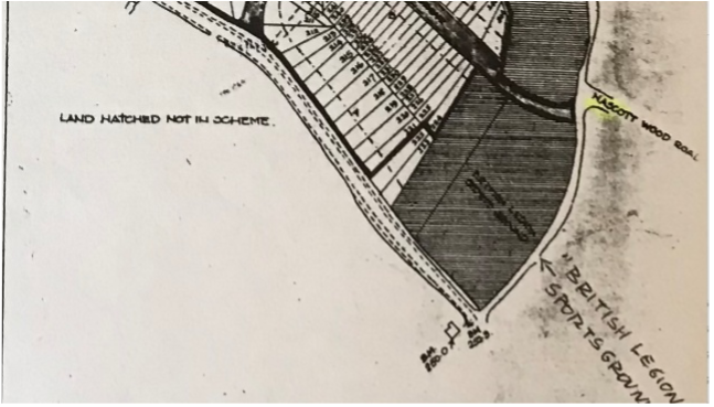
As the Estate was developed after 1934, broadly speaking from Ridge Lane westwards, so the roads were laid out. Local estate agents Stimpson, Lock and Vince gave particulars of the Estate and how it would be developed aimed at“builders, investors and speculators” who might be interested in buying land. On roads they […]
Bibliography
Various books and on-line sources have been used in this research including; ‘Directory of Stage Coach Services, . (1836′ (pub. 1969)). website for info on Sparrows Herne Trust. (n.d.). Retrieved from tringlocalhistory.org.uk (1825). In W. Pinnock, Pinnock’s History and Topography of England and Wales. [With Maps.]. Retrieved from https://www.google.co.uk/books/edition/Pinnock_s_History_and_Topography_of_Engl/B4Vd6drcn0kC?hl=en&gbpv=1&dq=russells+farm+estate+watford&pg=RA7-PA43&printsec=frontcover Ball, A. W. ((published 1973)). ‘Street […]