After WWI there was a boom in housing developments and land outside of the cities was cheaper to acquire and build. New travel links meant workers could now commute. Land around those links was used to build semi-detached properties which were cheaper to build, and could be purchased with a smaller affordable loan.
People moved to the new suburbs in droves, where they could purchase their dream homes. Over 4 million homes were built between 1919 and 1939 and the introduction of hire purchase meant people could equip their homes with the latest looks. By the end of the 1930s one family in three was living in an interwar house. Home ownership rose due to low interest rates, from 10% of families in 1914 to 31% by 1939
An article published in the Watford Observer on 5th March 2022 explains the background to housebuilding in Watford after the 1st World War.
“The Housing Act 1930 obliged local authorities to prepare slum clearance schemes for their areas. In a bid to finally rid the town centre of its unfit housing, Watford Council obtained funding to build the new 130-home Leavesden Green estate on the town’s northern periphery. Spacious homes with gardens were constructed, and the first tenants moved into Chilcot Road, Comyne Road, Desmond Road and Rosebriar Walk just before Christmas 1933. However, concerns were soon expressed about the practice of building homes in an area which, at the time, was not close to shopping parades, corner shops, schools, railway stations or places of employment”.
“The 1930s saw a new house building boom in Watford, this time powered by a demand to buy homes. The town’s prosperity was growing and mortgages were becoming more affordable. “No need to rent!” stated an advert from the National Building Society. “You can buy your house now, so easily, so safely, with the help of the National. There is no need to wait.” “
It would also seem that Watford Town Council was addressing the demand for 8,400 homes in the first ten years after WW2
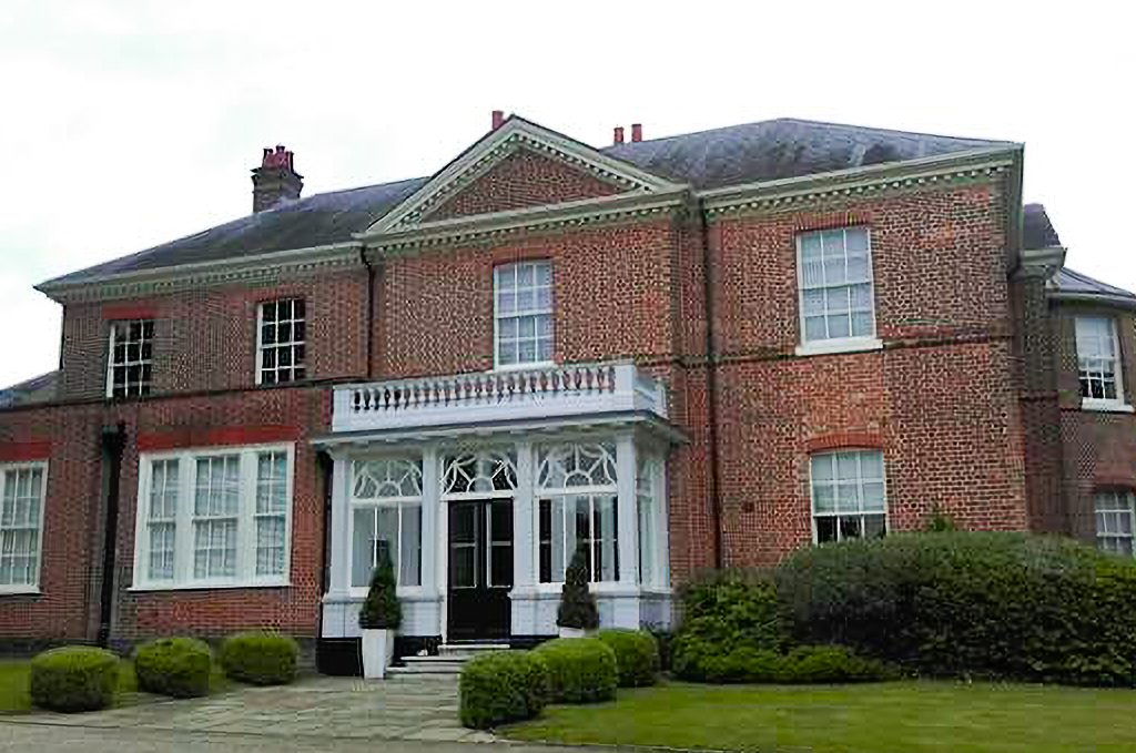
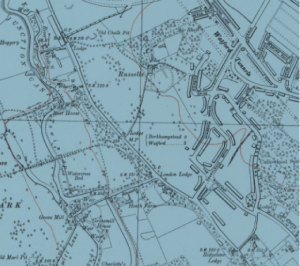
1930’s Russell Estate
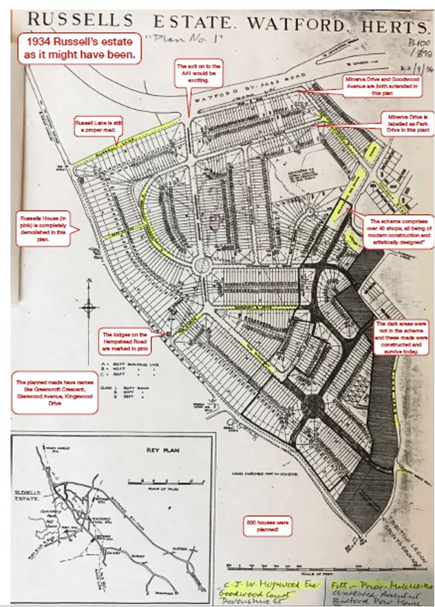
In January 1934: The Uxbridge and West Drayton Gazette reported that the Russell Estate was being mapped out for 845 homes.
In June 1934 Russells (Watford) Estates Ltd. was incorporated. A month later Charles J. W. Hopwood, Eustace E. Goodrich, Benjamin A. Woolf and Louis S. Woolf conveyed the Estate to the new company
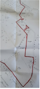
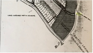
Note: the July 1934 conveyance map on the left shows that some areas of land adjoining Ridge Lane had already been sold off. By the time the proposed Development Plan was created later in 1934 it would appear more land next to Ridge Lane had been sold off.
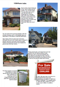
The company soon began to lay out new roads and services, and to sell building plots to individuals and local builders. The land was priced according to the length of road frontage. In 1948, for instance, it was about £8 per foot. The builders working on the estate at this time were mostly operating on a small scale and might only erect a few houses. This gave the houses a variety often absent in modern developments.
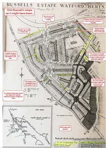
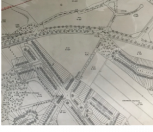
This diagram shows the original plan for the area by C J W Hopwood of Goodwood Court, Portland Place, London. (Goodwood Avenue may have been named after this address?)
The Watford Borough Council document ‘Character of Area’ (CoA, 2011) for this area says “However, the vast majority of development in this area took place during the 1930s with the construction of various privately built housing estates to the north of the 1920s development. New development was linked with the construction of the new distributor roads through the area, with the ‘Watford By-pass’ (A41) completed by 1929 and the ‘North Orbital’ (A405) completed in 1932.
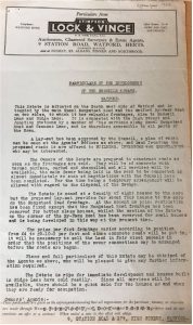
A document titled Particulars of the development of the Russells Estate, Watford by Stimpson, Lock & Vince says that a layout has been approved by the council and goes on to provide details about how the estate is to be designed/built.
Sale of Alcohol covenant
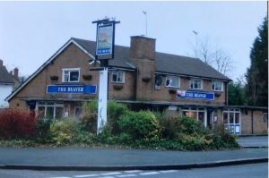
Note: On 31 July 1934 Russells (Watford) Estates Ltd sold a piece of land to Benskins on which the Beaver pub was eventually built. As part of the deal, Russells (Watford) Estates Ltd agreed to a covenant that in future no building on any part of the Estate could be erected where alcohol was sold. This covenant is included in the deeds of many of the properties in the area.
“Covenants in title deeds are legally binding promises related to a property, either restricting or obligating the owner to certain actions. They can be either positive (requiring action) or restrictive (prohibiting action). These covenants are typically written into the property’s title deeds and can affect how the land is used, maintained, or developed. “ (AI Overview 1/7/25
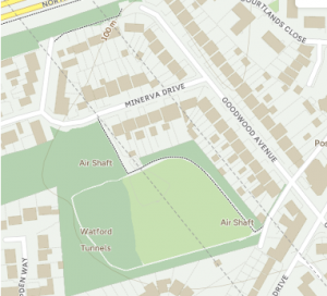
Goodwood Avenue and Minerva Drive
The area to the east of the estate seems to have been developed first including the building of houses along the existing Ridge Lane and creation of Courtlands Drive, Strangeways, and other new roads.
Goodwood Avenue and Minerva Drive sites, on the north were assessed as ‘ripe for development’ and approved by the council in 1933.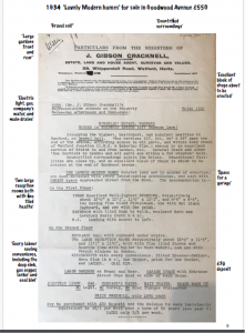
11 Minerva Drive was bought by William Clark of 15 Goodwood Parade 31 December 1936 for £575.
Goodwood Parade
“Many of the new communities created after the Second World War included a small neighbourhood ‘shopping centre’ in the form of a short parade.”
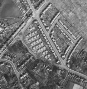
An aerial photograph of 1936 shows that most of the shops on ‘Goodwood Parade’ had been built. Details of occupants in the flats above the shops can be found in the 1939 census and details of the shops in directories such as Kelly’s. (Examples are included in a later section.)
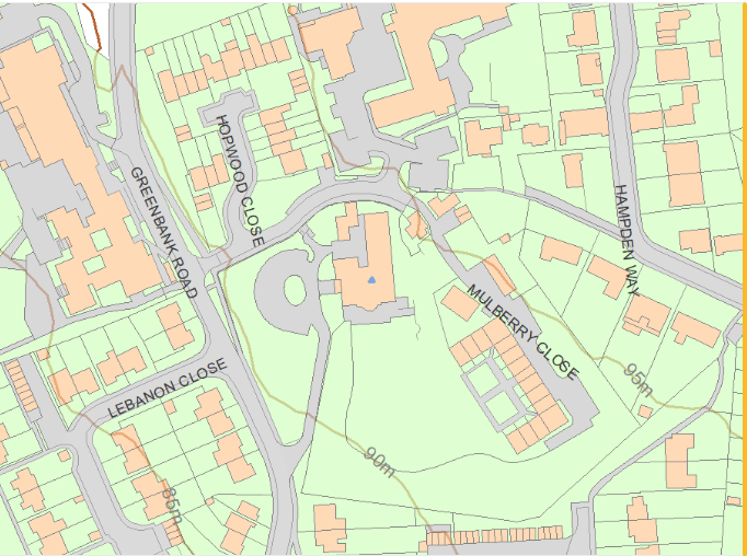
Note – Goodwood Avenue, Minerva Drive, Russell Lane and Russell House can all be seen. To the north the Kingswood estate is being created.
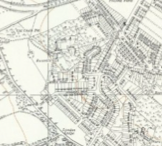
This map is an extract from Hertfordshire Sheet XXXIX.SW Revised: 1938, Published: ca. 1944
August 1939: The Eve of the Second World War
In 1939 the unsold part of the Estate was registered at the Land Registry simplifying, to some extent, the sale of the remaining plots. By then houses had been built on most of Courtlands Drive, Minerva Drive, Strangeways, Ridge Lane, Fairview Drive and Wimborne Grove. The Ridgeway had been partly developed, but not beyond its junction with Wimborne Grove towards Rosecroft Drive, which itself only contained about ten houses. The Drive, which was soon extended to the Hempstead Road (A411), was only to have houses built fronting it after the war. The “service road” (parallel to Hempstead Road), Greenbank Road, Hemingford Road and Lebanon Close were constructed after 1945.
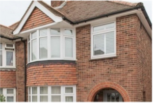
A simple, but by no means infallible, way of dating houses on the Estate is to count the chimneys! Generally, houses built before 1939 had fireplaces in the bedrooms. Post war houses generally did not, due to more efficient methods of heating and a desire to use less material.
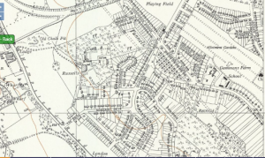
Note – Goodwood Avenue and Minerva Drive as well as other streets are now built. Gammons Lane runs all the way up to Russell Lane and forms a crossroad with the tree lined North Western Avenue A41. Few of the houses have garages.
See 1939 Register/Census for details of residents at this time.